Arabel syrt valley ascent to It Tish

Duration: depends on a program
Season: May – September
Route: Tamga – Ascent area - Tamga
Level of difficulty: we may adapt program either for beginners, either for professional mountaineers.
Description:
The whole South slope of Terskey Ala Too at altitude 3200-3700m represents so called Syrt area. Syrt in translation from Kyrgyz and other Turkish languages means Upland. Kyrgyz shepherds at all times used such areas for summer pastures – Djailoo.
Syrt is an upland that went through long denudation process – destruction and flattening under influence of glaciers, water and wind. Flat and not too deep river valleys, wide and hilly depressions are interchanged with flattened interfluves and not very high mountain ridges (up to 800m elevation) covered with snow-ice caps.
Surface and terrain of Syrt had been formed as a result of ancient glaciations. Therefore, all over you can see its signs – moraines grown into the ground, big boulders and “mutton foreheads” (curly rocks), shallow lakes with low and swampy shores, permafrost (spread above 3400m).
Glaciers on Syrt areas are short (usually 3-4км long). Arabel Syrt of Terskey Range is famous with its glaciers of flat summits, or so called “table glaciers”. It looks like ice sheet (cap, round loaf) on top of low-inclined summit surface of the ridge. Such glaciers are located on top of dividing ridges, and there is no way to get any kind of debris except air-dust, therefore moraines and other fragmental deposits are not much developed on its surface.
It Tish summit, which means Dog’s canine in Kyrgyz, is located right in such area of table glaciers. It-Tish is the highest point in the middle part of Terskey range (higher peaks are located only in the Eastern part of Terskey). Its height is 4808m. It rises as a huge pyramid and overtop nearest peaks on 200-300 m. Probably It Tish peak is the most interesting target in this area. However other peaks in the area are not less interesting for mountaineering.
Juuka gorge lies to the North of It-Tish peak and can be a good option to establish a Base Camp in forest area. It is remarkable among other gorges of Terskey range. It has expanded parallel to the main range, while all others are perpendicular. The gorge is deep and long. There are a lot of forest and alpine meadows around there. Many local shepherds stay there in summer time with cattle. Base camp in the bottom of the gorge is easy accessible by 4wd car and suppose not too long approaches to summits.
Approach.
There are two ways to get into area of It-Tish and nearest peaks.
One way goes over Barskoon pass (3754m) following to the East side of Arabel Syrt valley. Road has excellent gravel surface, as supported by Kumtor gold mining company. This way is easily accessible almost by all kinnds of transport. The way by car from Tamga village is 80km long. Further it is necessary to take hiking approach to desired base camp. There is around 10-15km till It-Tish pass. For transportation of gear and food it is possible to use help of porters of horses. Hiking way is not difficult, because it goes along flat valley with minimum elevation. But the fact of being at altitude 3800m may bring some difficulties for people without good acclimatization. The whole approach from Tamga village to BC is possible to do in one day.
Second way supposes driving to Saru village on the South Shore of Issyk-Kul Lake. Then turn to South on earth road. First 10km (till confluence Djuuka-Djuukuchak) goes along more or less good road, suitable for most of cars. But further way to the upper reaches of Djuuka valley is passable by 4wd cars only. Depending on situation with bridges and fords it is usually possible to drive till Kashka Suu river or bit further. And sometimes even till Dongurome river. BC can be established in many places along the valley, where the car reach. Also it is possible to move BC higher to side valleys using help of porters or horses. Usually such way takes another 1-2 days, depending on the goal.
First way is easiest and fastest on the way to It-Tish and nearest peaks. If your goal is just summit, then it is the best solution.
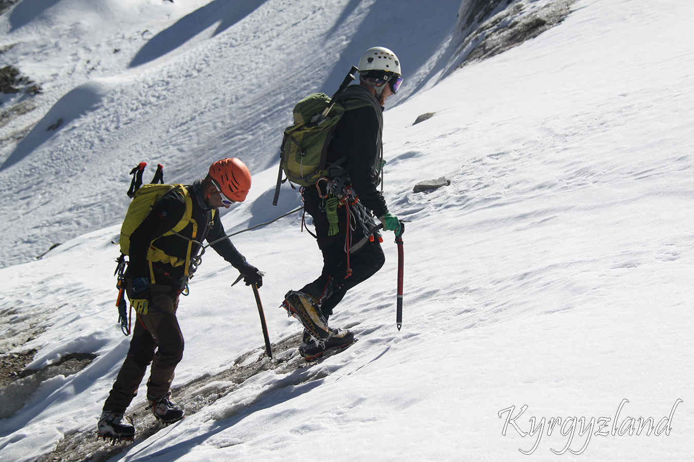
Necessary equipment:
Sunscreen (at least 20SPF);
Lip balm;
Sunglasses with UV protection;
Gloves;
At least 35 Liter backpack for climbing;
Sleeping bag;
Sleeping mat;
Telescopic poles;
Head lamp & batteries;
Crampons;
Helmet;
Ice axe;
Harness;
Alpine tuber;
Rope;
4 carbines;
Self-clothes;
Climbing shoes;
Feather clothes.
If required, possible to rent alpine equipment.