Trekking to the country of Giants

Duration: 11 days, 10 nights
Season: July – August
Route: Karakol – Echkili Tash – Tuz pass – Merzbacher Lake – Komsomolec glacier – Base Camp under Khan Tengri and Pobeda Peaks – Karkara/Maida Adyr – Karakol
Level of difficulty: program is suitable for active people with good health, able to acclimatize on 4000m above the sea level and make hiking passages for 6-7 hours a day.
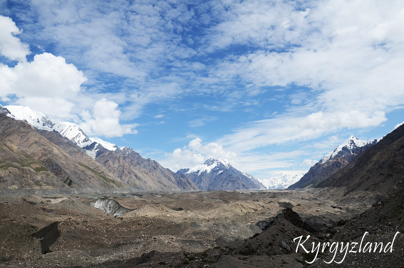
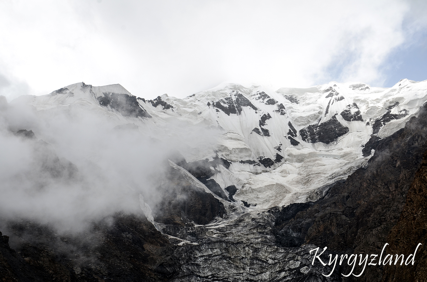
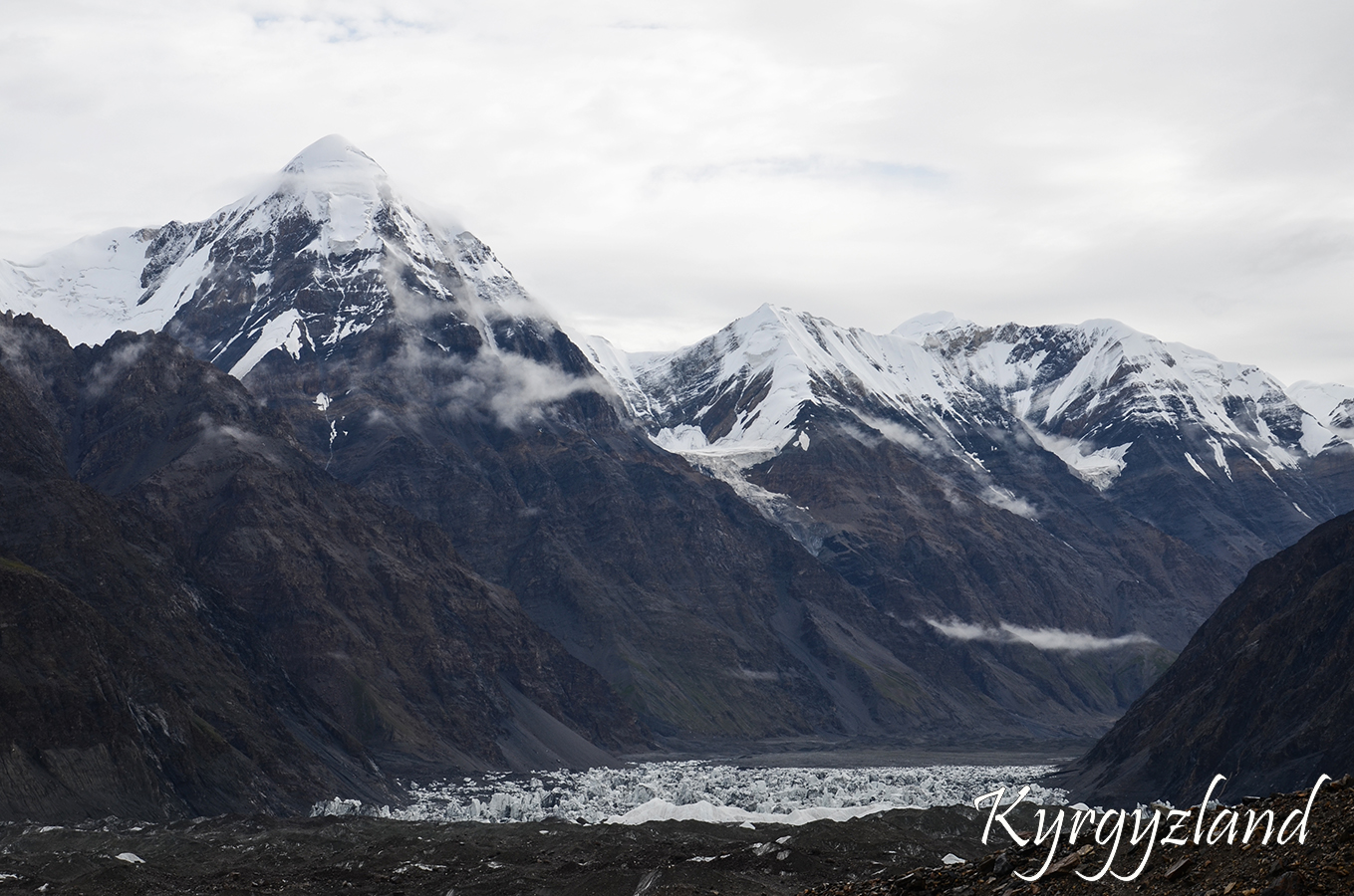
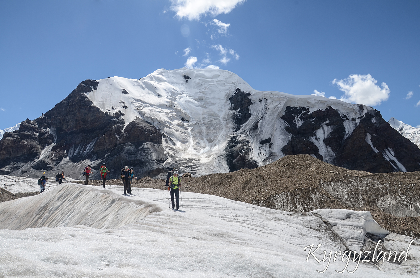
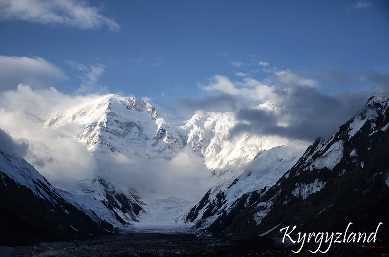
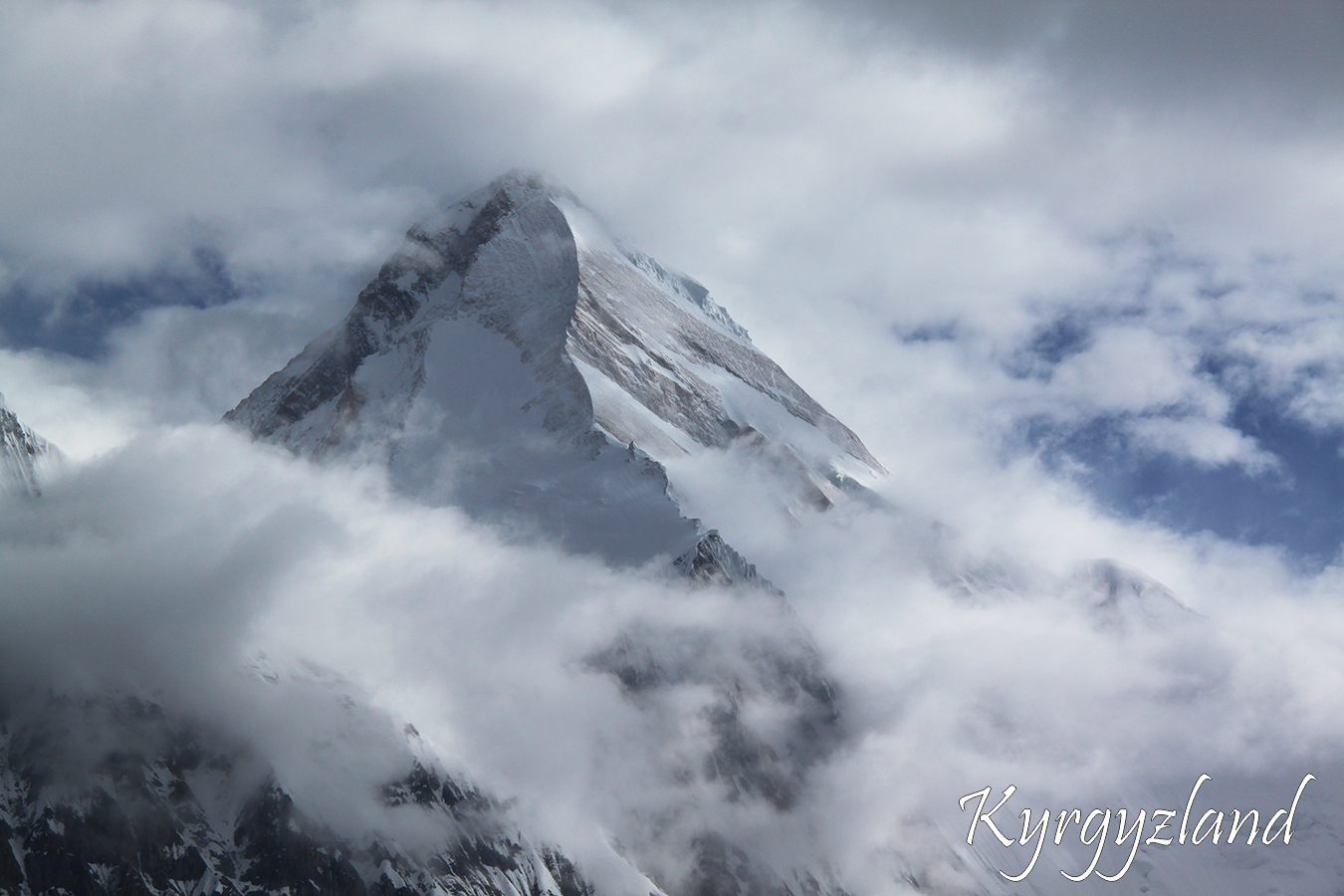
The most high-mountainous alpine zone of Kyrgyzstan is situated in the vicinity of the Northern and Southern Inylchek glaciers. The valleys of these glaciers are formed by the main ranges. These are Sarydzhas range, Tengri-Tag range, Kokshaal-Too range and Meridional range. One of the biggest glacier in CIS is Southern Inylchek, its length is 62 km, its width is 3,5 km, the thickness of ice is more than 200 m. In the upper reaches of this glacier there are two 7000 m. peaks - Pobeda peak and Khan-Tengry peak and about 30 peaks of more than 6000 m. and also many peaks of 4000 - 5000 m. with different levels of difficulty, from simple to sheer walls. Among them there are peaks which never been climbed.
At the confluence of the Northern and Southern Inylchek glaciers is Merzbacher lake. The lake is very interesting, because once a year, usually in the first half of April, it breaks down to the valley of Inylchek river. The mechanism of breaking down is still unexplored.
Climate conditions in the Alpine zone are rather severe, for the basic camp is situated on 4000 m. above the sea level, and more than 50 % of the territory is covered by eternal snow. Daytime temperature drop from +7 to 15°C. At night the temperature is usually below 0°C.
Above 5000m. The climate is mostly Arctic. The weather in this region is extremely unstable with often snow, and on the slopes of Khan-Tengry and Pobeda peaks bad weather turns to storms which don't allow to ascent.
Day 1
Karakol – Sary Djaz valley – Tuz gorge
Transfer from Karakol to Sary Djaz valley. Passing through border control on Echkilik Tash frontier post. Then crossing Sary Djaz river by bridge, walking for 30-40min and stop for overnight in tent camp. (LD)
Altitudes (above sea level): Echkilik Tash post – 2900m, overnight point – 2950m.
Time on the way is 5-6 hours.
Day 2
Tuz gorge
Hiking to the upper of Tuz gorge. This is not difficult passage. The path goes along flat grassy slope. Overnight in tent camp. (BLD)
Altitudes (above sea level): Highest point & overnight point – 3300m.
Time on the way is 5-6 hours.
Day 3
Tuz gorge – footstep of Tuz pass
Wading Tuz river, hiking to the foot of Tuz pass along river-bed in the steep gorge. Placing camp for overnight near huge rock, cracked into two parts. (BLD)
Altitudes (above sea level): Highest point & overnight point – 3600m.
Time on the way is 5-6 hours.
Day 4
Tuz pass – Inylchek valley
Ascent to Tuz pass. It is difficult but not long way and takes 1,5-2hours. On the pass you may see huge massive of Nansen peak and also summit of Pobeda peak far off in the East. After lunch we have long descent to Inylchek river. Overnight in tent camp near huge boulder called Chon Tash. (BLD)
Altitudes (above sea level): Tuz pass – 4001m, overnight point – 2850m.
Time on the way is 5-6 hours.
Day 5
Inylchek glacier
Hiking over Inylchek glacier, to its opposite side. Then moving alongside moraine. Stop, after crossing Putevodniy glacier, on small clay spot of the mountainside. Overnight in tent camp. (BLD)
Altitudes (above sea level): Highest point & overnight point – 3200m.
Time on the way is 5-6 hours.
Day 6
Merzbacher Lake
Trekking along flank moraine of the glacier to Merzbacher's meadow. The passage during this day is not difficult and short. In the second part of the day having rest. Overnight in tent camp. (BLD)
Altitudes (above sea level): Highest point & overnight point – 3450m.
Time on the way is 3-4 hours.
Day 7
Mercbacher Lake
Radial trip to Mercbacher lake. The lake is situated on the other side of glacier; therefore, it is necessary to cross it twice. Width of the glacier is around 3km Overnight in tent camp. (BLD)
Altitudes (above sea level): Highest point & overnight point – 3450m.
Time on the way is 5-6 hours.
Day 8
Komsomolsky glacier
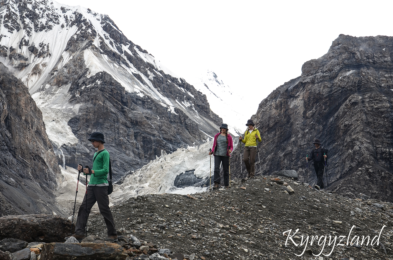
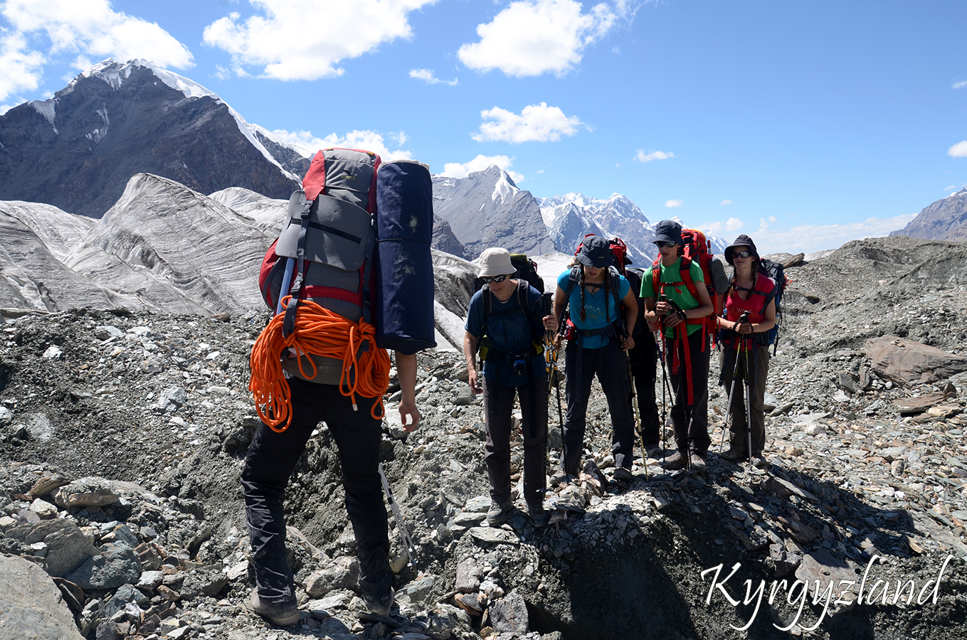
Hiking along Inylchek glacier to the confluence with Komsomolsky glacier. The way lies along moraines and among “seracs” (small ice hills, up to 5m high). Overnight in tent camp. (BLD)
Altitudes (above sea level): Highest point & overnight point – 3900m.
Time on the way is 5-6 hours.
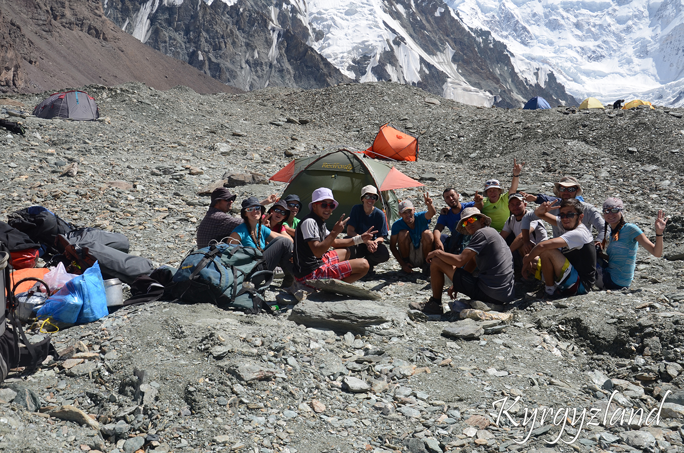
Day 9
Komsomolsky glacier – Base Camp
Hiking along from Komsomolsky glacier to Base Camp under Khan Tengri (7010m) and Pobeda peak (7439m). Overnight in tent camp. (BLD)
Altitudes (above sea level): Base Camp – 4100m.
Time on the way is 6-7 hours.
Day 10
Day of rest
Extra day in case of bad weather or chapter of accidents. Otherwise having rest in the BC and admiring Grand summits of Pobeda and Khan Tengri Peaks. Radial hike towards Dikiy glacier.
Altitudes (above sea level): Base Camp – 4100m.
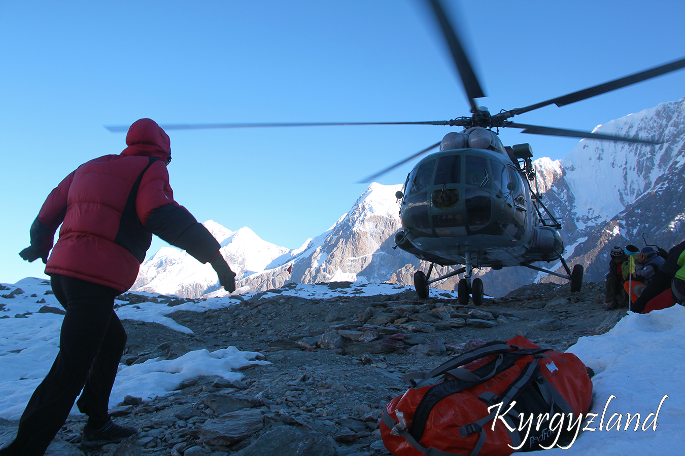
Day 11
Helicopter flight
Return to Karkara or Maida-Adyr by helicopter. And then transfer to Karakol city. (BLD)
Altitudes (above sea level): Base Camp – 4100m, Karakol – 1800m.
Service includes:
Double or twin accommodation in tents;
Transport for transfers during tour;
Cook and full board during tour;
English speaking mountain guide;
Tents, kitchen and camping equipment during tour;
Porters during trekking to carry up to 10kg of your private stuff (for each person).
Service doesn't include:
Accommodation in hotels before and after the program;
Single supplement;
Alcohol and soft drinks;
Transfers, excursions or horse riding over the program etc.;
Visa and invitation letter to Kyrgyzstan;
Medical insurance.
Clothing and Equipment:
Sunscreen (at least 20SPF);
Chapstik or equivalent lip balm;
Sunglasses with UV protection;
At least a 25 Liter backpack for personal items;
Sleeping bag;
Sleeping mat;
Belay;
Crampons(for glacier walk);
Telescopic trekking sticks poles (optional);
Head lamp (eg Petzl) spare bulbs & batteries;
T-Shirts, long-sleeved T-shirt, shorts;
Trekking pants;
Underwear;
Fleece jacket or pullover;
Fleece Wind-Stopper jacket (optional);
Down vest and/or jacket (optional);
Waterproof jacket (Gore-Tex) with hoody;
Waterproof pants (Gore-Tex);
Thick, warm wool hiking socks - 2 pairs (for sleeping in tents cotton socks - 3 pairs);
Thin gloves for trekking and overnight;
Sun hat or scarf;
Warm fleece hat or light balaclava;
Trekking/Hiking boots with spare laces;
Footwear for around camp, running shoes and/or sandals;